Žalsvasis šaltinis – The Deepest Spring in Panevėžys, Lithuania
Discover the hidden gem of Lithuania’s countryside, a crystal‑clear spring that plunges 20 m into the earth. Whether you’re a nature lover, a photography enthusiast, or simply looking for a tranquil spot off the beaten path, Žalsvasis šaltinis (literally “Green‑ish Spring”) offers a unique slice of Lithuanian wilderness.
1. Introduction
Imagine standing at the edge of a quiet forest clearing, the air scented with pine and fresh earth, and hearing the gentle murmur of water that has been bubbling up from a hidden underground chamber for decades. This is the experience awaiting you at Žalsvasis šaltinis, the deepest natural spring in Lithuania. Located just a short drive from the historic city of Panevėžys, this spring is not only a geological wonder—its water emerges from a sinkhole that first appeared around 1960—but also a peaceful retreat that captures the spirit of Lithuanian nature.
If you’re planning a road trip through the Baltic states, a weekend getaway in Lithuania, or a day‑trip from Panevėžys, add Žalsvasis šaltinis to your itinerary. In this guide we’ll cover everything you need to know: the spring’s story, how to get there, the best time to visit, what you’ll see, nearby attractions, and practical travel tips.
2. About Žalsvasis šaltinis
A Natural Wonder
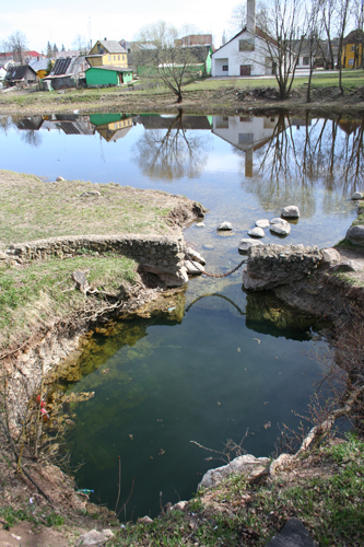
Žalsvasis šaltinis is a spring (Lithuanian: šaltinis) situated in the Pasvalys district of Panevėžys County. According to the Lithuanian Wikipedia page, it is the deepest spring in the country, with a measured depth of 20 meters. The water surfaces from a smegduobė—a natural sinkhole—first observed in the early 1960s. Over the past six decades, the spring has remained a relatively untouched natural feature, offering a glimpse into the underground water systems that feed Lithuania’s rivers and lakes.
Historical Snapshot
The spring’s emergence coincided with a period of agricultural expansion in the region. While there are no grand legends or medieval tales attached to Žalsvasis šaltinis, its modest history is part of the broader story of Lithuania’s post‑war development, when many rural areas were surveyed for water resources. The spring’s name, “Žalsvasis,” hints at the subtle green‑ish tint of its water, a characteristic that locals have noted for generations.
Why It Matters
Beyond its depth, Žalsvasis šaltinis is an important ecological site. Springs like this provide clean, mineral‑rich water that supports surrounding flora and fauna. The area around the spring is a small, semi‑natural meadow that attracts birds, insects, and occasional deer, making it a quiet spot for wildlife observation. For geologists and hydrologists, the spring offers a natural laboratory to study karst processes—how water dissolves soluble rocks to create underground cavities.
3. How to Get There
By Car
The most convenient way to reach Žalsvasis šaltinis is by car. From the center of Panevėžys, follow these steps:
- Head east on A1/E85 toward Pasvalys.
- After approximately 30 km, take the exit for Pasvalys–Utena road (DK 150).
- Continue on DK 150 for 6 km, then look for signs pointing to Žalsvasis šaltinis (the local road may be unmarked; a GPS coordinate is the safest guide).
- Turn onto the gravel road that leads directly to the spring.
The total driving time is about 45 minutes (≈55 km). Parking is available in a small lot near the spring’s entrance; a short walk (≈200 m) brings you to the water’s edge.
By Public Transport
If you prefer not to drive, you can combine bus and taxi:
- Bus: Take a regional bus from Panevėžys to Pasvalys (routes 3A/3B). Buses run roughly every hour during weekdays and less frequently on weekends.
- Taxi/ride‑share: From Pasvalys, a local taxi (or a ride‑share service like Bolt) can take you the remaining 10 km to the spring. The ride costs about €12–15.
Walking & Cycling
For the adventurous, the route from Pasvalys to Žalsvasis šaltinis is bike‑friendly on quiet country roads. Expect a 10–12 km ride with gentle elevation changes.
Coordinates & Map
- Latitude: 56.064517
- Longitude: 24.400867
Plug these coordinates into Google Maps, Apple Maps, or any GPS device for pinpoint navigation.
4. Best Time to Visit
Spring (April – June)
Early spring brings fresh growth to the surrounding meadow, and the water temperature is still cool—perfect for a brisk walk and crisp photographs.
Summer (July – August)
Mid‑summer offers the warmest weather (average highs around 22 °C / 72 °F). The meadow is lush, and the longer daylight hours give you more time to explore. However, be prepared for occasional thunderstorms, which can temporarily raise the water flow.
Autumn (September – October)
Autumn is arguably the most photogenic season. Golden foliage frames the spring, and the cooler air makes hiking comfortable. The water remains clear, and you’ll encounter fewer visitors.
Winter (November – March)
The spring can freeze over in particularly cold spells, creating a striking icy tableau. Access is still possible, but the path may be slippery, and the surrounding area can be covered in snow. If you enjoy winter landscapes, bring sturdy boots and consider a guided visit.
Overall recommendation: Late spring to early autumn (May‑September) provides the best combination of weather, accessibility, and natural beauty.
5. What to Expect
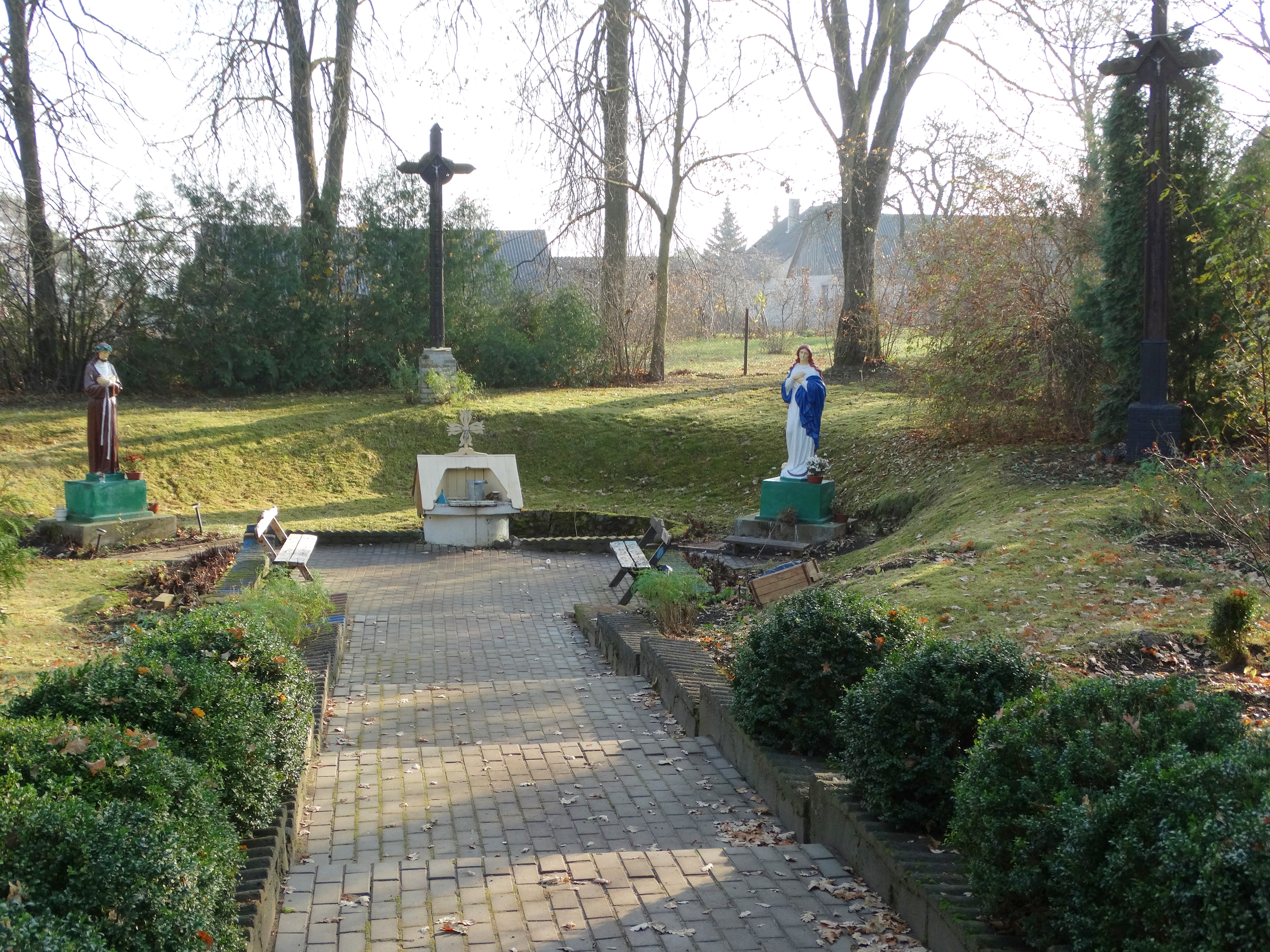
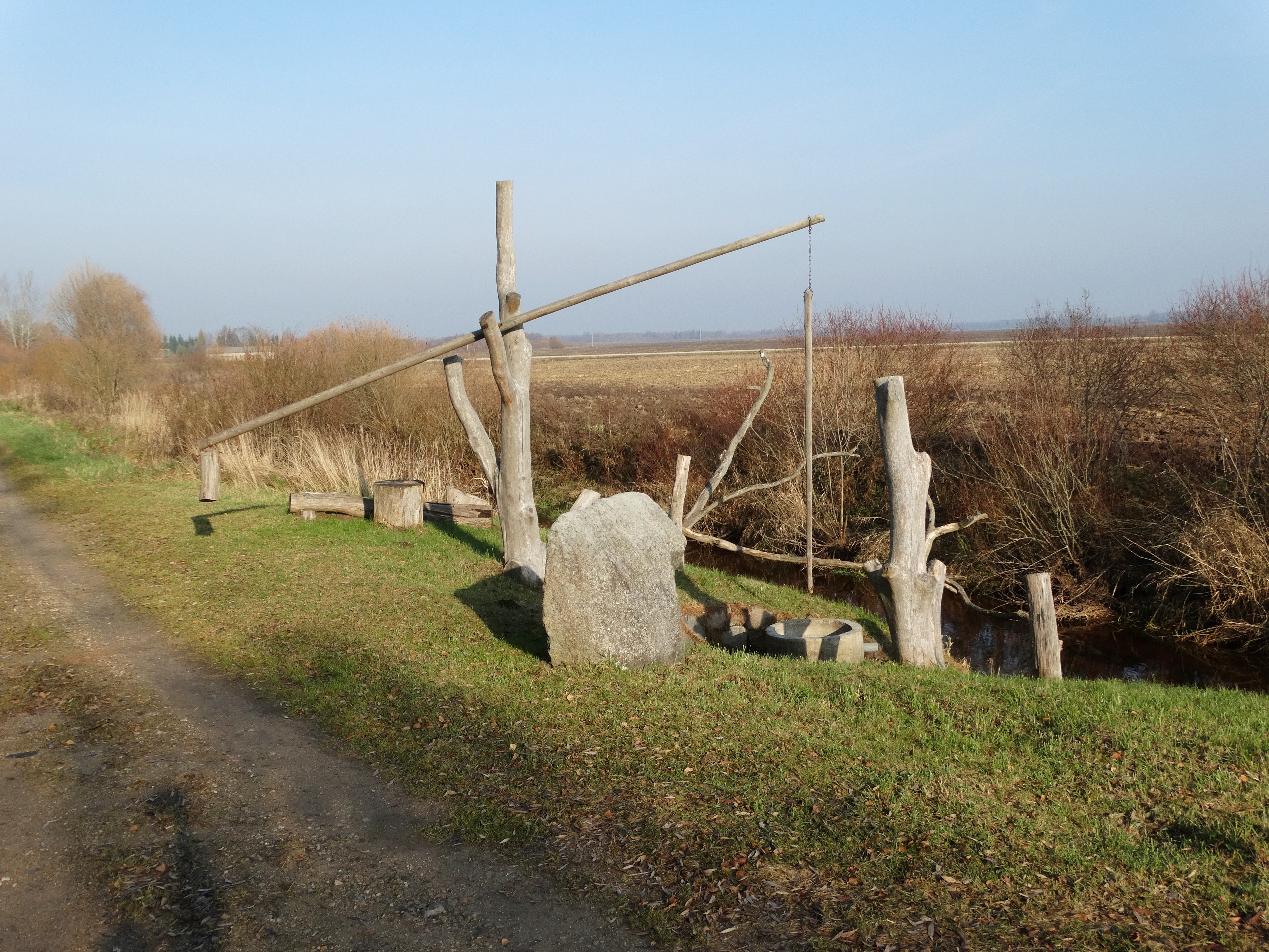
The Setting
When you arrive, you’ll find a modest wooden sign marking the site, followed by a short, well‑maintained trail that leads to a small clearing. The spring itself appears as a clear, steady stream emerging from a shallow depression in the ground. The water is remarkably transparent, revealing the rocky bottom and the faint greenish hue that inspired its name.
Sensory Experience
- Sight: The contrast of crystal water against moss‑covered stones and surrounding grass creates a serene tableau. In summer, dragonflies skim the surface, and occasional fish can be seen darting near the edge.
- Sound: A gentle, continuous trickle provides a calming background noise, perfect for meditation or a quiet picnic.
- Touch: If you’re brave enough, you can dip your hand into the cool water—its temperature stays around 8 °C (46 °F) year‑round, a refreshing sensation on a warm day.
Activities
- Photography: The spring’s depth and clarity make for striking macro shots of water droplets, as well as wide‑angle landscape images framed by surrounding trees.
- Birdwatching: The meadow attracts species such as the Eurasian skylark, goldfinch, and occasional common buzzard soaring overhead.
- Picnicking: A small wooden bench sits near the water, ideal for a light snack. Remember to bring your own waste bag—there are no trash bins on site.
Facilities
Žalsvasis šaltinis is a natural, undeveloped site. There are no restrooms, cafés, or souvenir shops. The emphasis is on preserving the pristine environment, so visitors are encouraged to practice Leave No Trace principles.
6. Nearby Attractions
While Žalsvasis šaltinis can easily fill a half‑day, the surrounding Panevėžys region offers additional points of interest within a short drive. Below are the most convenient sites, each located less than 2 km away (except the last, a bit farther).
| Distance | Attraction | Type | Approx. Travel Time | Link |
|---|---|---|---|---|
| 0.4 km | Panevėžys Fountain | Fountain | 2 min walk | View on Map |
| 0.4 km | Local Weir #1 | Weir | 3 min walk | View on Map |
| 1.0 km | Local Weir #2 | Weir | 12 min walk | View on Map |
| 1.1 km | Second Fountain | Fountain | 15 min walk | View on Map |
| 6.8 km | Draustinio g. Dam | Dam | 10 min drive | View on Map |
These spots are perfect for a quick stretch, a photo stop, or a brief exploration of Panevėžys’s water‑related heritage.
7. Travel Tips
| Tip | Details |
|---|---|
| Bring proper footwear | The path to the spring can be muddy after rain; sturdy, waterproof shoes or hiking boots are advisable. |
| Check the weather | While the spring is accessible year‑round, heavy rain may increase water flow and make the trail slippery. |
| Pack a picnic | No food vendors are on site. A simple sandwich, fruit, and a reusable water bottle will keep you refreshed. |
| Respect the environment | Take all litter with you. The area is a protected natural site, so avoid picking plants or disturbing wildlife. |
| Photography gear | A polarizing filter helps reduce glare on the water surface; a macro lens captures the tiny bubbles and stone textures. |
| Mobile signal | Coverage can be spotty. Download offline maps (Google Maps offline area) before you arrive. |
| Currency | Lithuania uses the Euro (€). While the spring itself is free, nearby cafés in Panevėžys accept cards and cash. |
| Language | Lithuanian is the official language; most locals in tourism areas speak English, especially younger generations. |
| Safety | The water is cold; avoid swimming. The depth of the spring (20 m) is not suitable for recreational diving. |
| Timing | Arrive early in the morning (7 – 9 am) to enjoy the site with fewer visitors and softer light for photos. |
8. Final Thoughts
Žalsvasis šaltinis may not appear on the typical “top‑10 Lithuania” lists, but that is precisely why it feels like a secret treasure. Its deep, crystal‑clear waters, quiet meadow setting, and proximity to Panevėžys make it an ideal stop for travelers seeking authentic Lithuanian nature without the crowds.
Whether you’re mapping out a Lithuania travel itinerary, hunting for natural springs in the Baltic region, or simply craving a peaceful place to pause and listen to the gentle sound of water, Žalsvasis šaltinis delivers. Pack your camera, lace up your boots, and head to coordinates 56.064517, 24.400867—the green‑ish spring is waiting.
Happy travels, and may the serenity of Žalsvasis šaltinis stay with you long after you leave!