Wasserfassung Etzlibach – A Hidden Weir Gem in the Heart of Uri, Switzerland
Discover the quiet power of a Swiss weir, the breathtaking Alpine backdrop, and the charm of Silenen’s river valleys.
Introduction
If you’re chasing the off‑the‑beaten‑path side of the Swiss Alps, the Wasserfassung Etzlibach is a perfect stop. Tucked away in the rugged canton of Uri, this modest weir (or “Wehr” in German) may not have the fame of the Matterhorn, but it offers a unique glimpse into Switzerland’s historic hydro‑power heritage, pristine mountain scenery, and tranquil river life. Whether you’re a photography enthusiast, a hiking aficionado, or simply a traveler who loves discovering hidden engineering marvels, Etzlibach invites you to pause, listen to the rushing water, and soak up the Alpine atmosphere.
About Wasserfassung Etzlibach
What is it?
- Name: Wasserfassung Etzlibach
- Type: Weir (hydraulic structure) 🚧
- Location: Silenen, Uri, Switzerland
- Coordinates: 46.766047 N, 8.704569 E
A Wasserfassung is a small‑scale water‑capture structure that diverts part of a river’s flow into a channel or reservoir for hydro‑electric generation. The Etzlibach weir sits on the Etzlibach stream, a tributary that eventually feeds the Kraftwerk Amsteg (Amsteg Power Plant) — a key component of Uri’s clean‑energy network. While the exact height and altitude of the weir are not publicly listed, its presence is unmistakable: a low concrete barrier, a subtle spillway, and a gentle roar that blends with the surrounding forest.
A Brief History
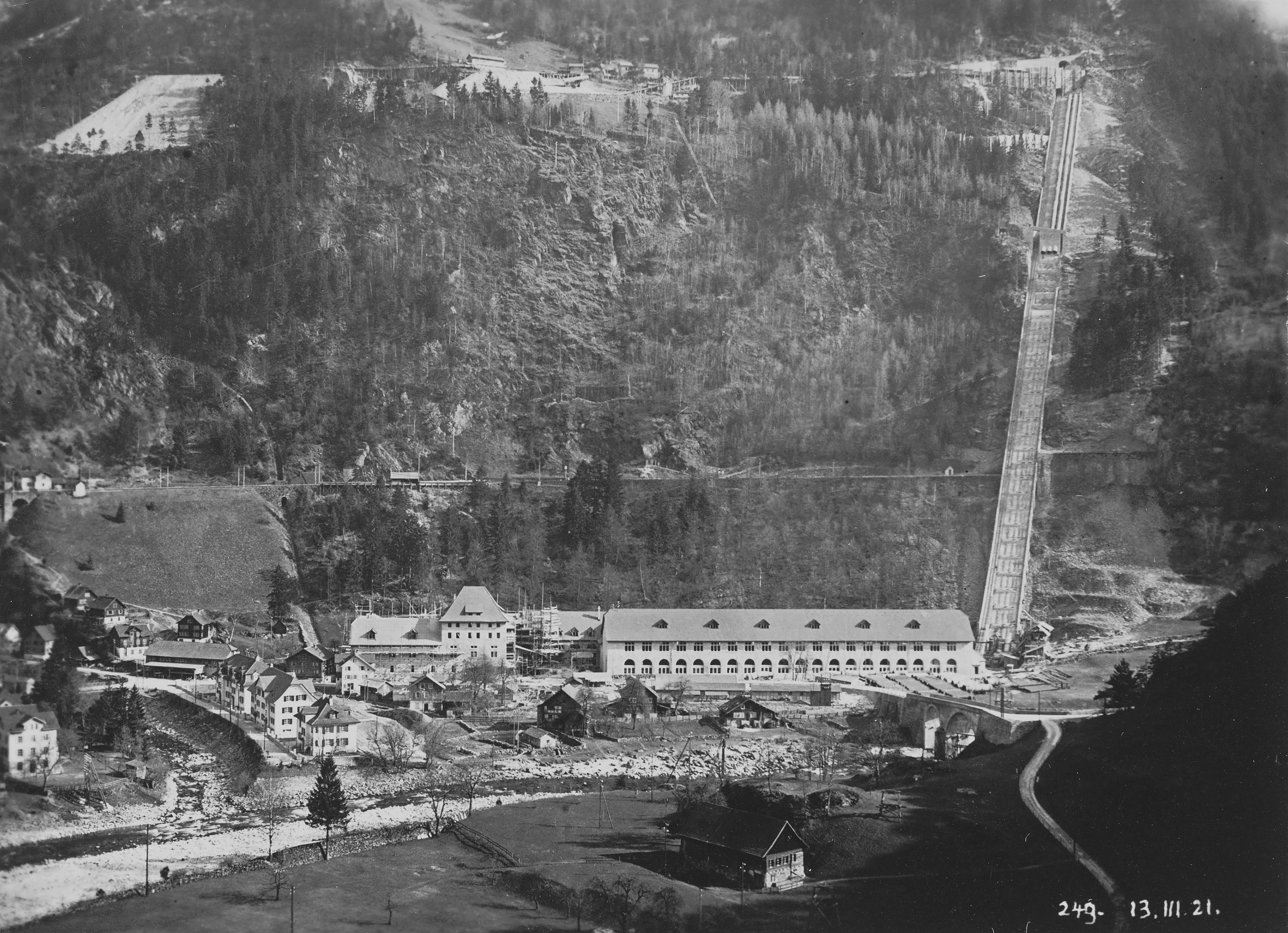
The Etzlibach weir was constructed as part of the early‑20th‑century expansion of Uri’s hydro‑electric system. The Kraftwerk Amsteg (see the German Wikipedia entry: https://de.wikipedia.org/wiki/Kraftwerk_Amsteg) began operations in the 1920s, harnessing the power of the Reuss River and its tributaries. The Etzlibach water capture point was added later to increase water availability during low‑flow periods, ensuring the power plant could run year‑round. Over the decades, the weir has been quietly maintained, blending into the landscape while continuing to serve its purpose.
Why It Matters
- Renewable Energy: Etzlibach contributes to Switzerland’s reputation as a leader in clean energy, feeding water into the Amsteg hydro‑electric system.
- Cultural Landscape: The weir reflects the Swiss tradition of integrating engineering with nature, preserving both functionality and aesthetic harmony.
- Outdoor Appeal: The surrounding valley offers excellent hiking, bird‑watching, and photo opportunities, making the site a small but rewarding destination for nature lovers.
How to Get There
By Train & Bus
- Zurich → Gotthard Base Tunnel – Take an InterCity (IC) train from Zurich HB to Altdorf (approx. 1 h 15 min).
- Altdorf → Amsteg – Transfer to a regional train on the Gotthard line (about 20 min). Amsteg is the closest station to Silenen.
- Amsteg → Silenen – From Amsteg, catch the PostAuto bus 613 toward Silenen (≈ 10 min). The bus stops near the village centre, a short walk to the Etzlibach road.
By Car
- From Zurich: Drive south on the A2 (Gotthard Motorway) toward Altdorf, then follow signs for Silenen/Amsteg (approx. 90 km, 1 h 15 min).
- Parking: A small public parking area is located near the Silenen village hall. From there, a marked forest trail leads to the weir in about 10–15 minutes.
On Foot or Bike
If you’re staying in Silenen or Amsteg, the Etzlibach weir is reachable via a well‑maintained hiking path (grade T2). The trail follows the Etzlibach stream, offering river views and occasional wooden bridges. Cyclists can use the same route, but be prepared for some gravel sections.
Best Time to Visit
| Season | Highlights | Weather & Tips |
|---|---|---|
| Spring (April‑June) | Snowmelt swells the stream, creating dramatic water flow and vibrant alpine flora. | Temperatures 8‑15 °C; wear waterproof shoes. |
| Summer (July‑September) | Long daylight hours, clear skies, and lush green meadows. Ideal for photography. | 15‑25 °C; bring sunscreen and a hat. |
| Autumn (October‑November) | Golden foliage along the trail; quieter visitor numbers. | 5‑12 °C; a windproof jacket is advisable. |
| Winter (December‑March) | Snow‑covered landscape; the weir becomes a serene white sculpture. | Sub‑zero; trail may be icy—use crampons or snowshoes. |
Peak recommendation: Late June to early September for the best combination of water flow, trail conditions, and weather.
What to Expect
Arriving at the Wasserfassung Etzlibach, you’ll first notice the gentle hum of water over the concrete spillway. The weir itself is modest—just a few meters wide—but its engineering elegance is evident in the smooth curvature of the downstream side, designed to reduce turbulence.
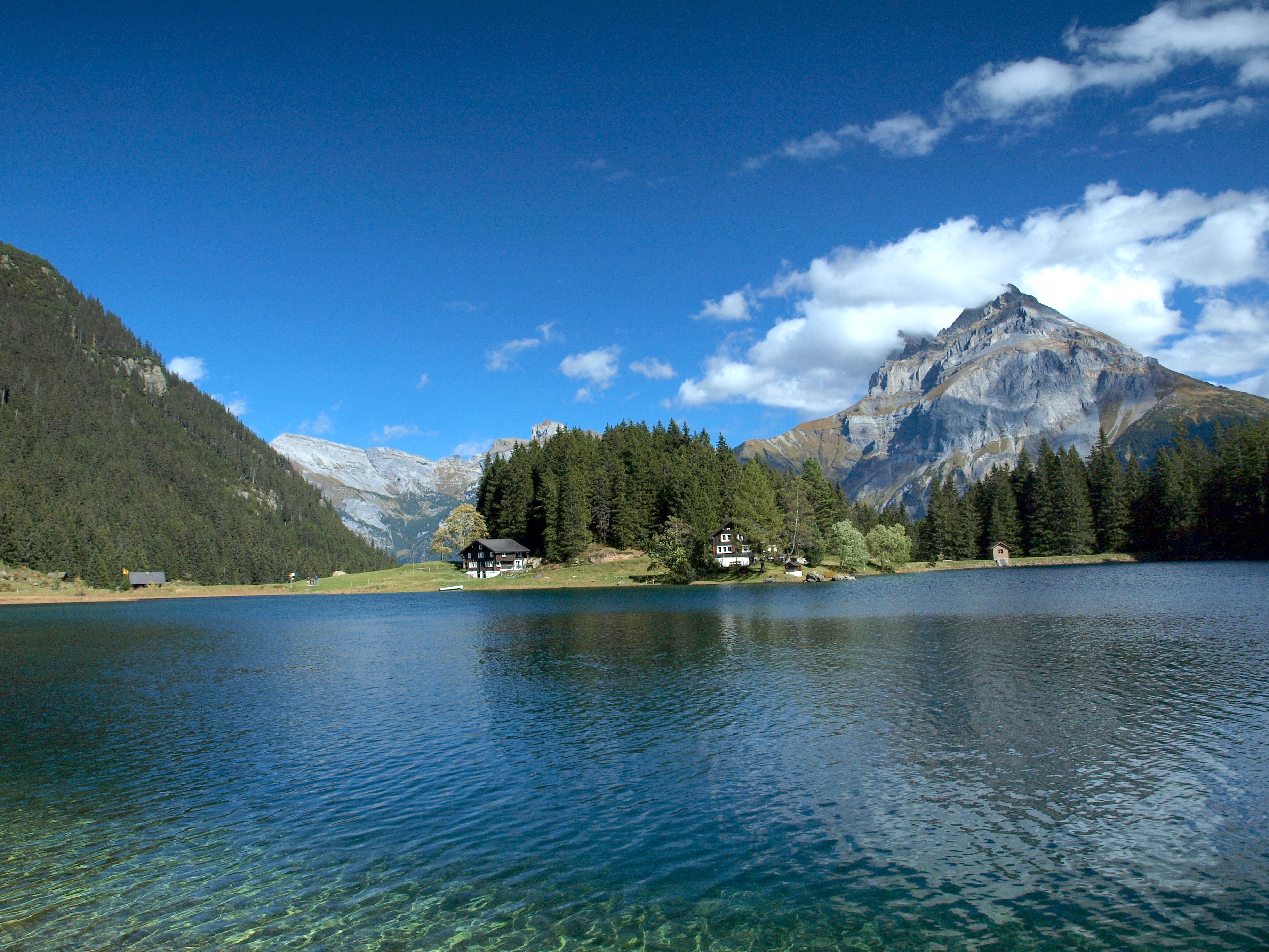
- Scenic Views: The Etzlibach valley opens up to towering limestone cliffs and dense spruce forests. From the weir’s edge you can see the Reuss River in the distance, winding through the classic Uri landscape.
- Wildlife: Keep an eye out for alpine chamois, red‑breasted bullfinches, and occasionally a beaver family working along the banks.
- Photography: Early morning light creates misty ribbons over the water, while late afternoon sun paints the surrounding rocks in amber tones. A tripod and a polarizing filter will help capture the reflective surface of the stream.
- Quiet Atmosphere: Unlike the bustling tourist spots of Lucerne or Interlaken, Etzlibach offers a meditative setting—perfect for a short meditation, a picnic, or simply listening to the river’s rhythm.
Nearby Attractions
While you’re in the area, consider extending your itinerary to include these nearby natural and cultural sites (all within a 5 km radius):
-
Wasserfassung Chärstelenbach – Another small weir just 0.4 km away. Great for a quick comparative look at Uri’s water‑management network.
- Map & Directions -
Wasserfassung Lägni – Located 2.2 km from Etzlibach, this weir sits in a more secluded valley, ideal for a longer hike.
- Map & Directions -
[Unnamed Spring] – A natural spring 2.9 km away, offering crystal‑clear water and a pleasant spot for a short break.
- Map & Directions -
[Unnamed Spring] – Another spring 3.0 km distant, surrounded by alpine wildflowers in summer.
- Map & Directions -
[Unnamed Dam] – A small dam 4.5 km away, part of the broader hydro‑electric system feeding the Kraftwerk Amsteg.
- Map & Directions
Tip: All these spots are reachable via the same network of marked trails that lead from Silenen. Pack a day‑pack, water, and a map, and you can create a mini‑tour of Uri’s water‑engineered landscape.
Travel Tips
| Tip | Details |
|---|---|
| Bring Proper Footwear | Even in summer, the trail can be wet and slippery near the weir. Sturdy hiking boots with good grip are essential. |
| Respect the Environment | The area is part of a protected watershed. Stay on marked paths, avoid littering, and do not disturb any signage or safety barriers. |
| Check Train & Bus Schedules | Swiss public transport runs like clockwork, but early morning or late evening services may be limited, especially on weekends. Use the SBB app for real‑time updates. |
| Pack a Light Picnic | There are no cafés directly at the weir, but a small snack and a thermos of coffee make for a pleasant break with a view. |
| Photography Gear | A wide‑angle lens (14‑24 mm) captures the valley, while a telephoto (70‑200 mm) helps isolate wildlife. A small rain cover for your camera is advisable. |
| Safety First | The water can be deceptively fast. Keep a safe distance from the spillway, especially after heavy rain or snowmelt. |
| Language | The local language is Swiss German. Most signs are bilingual (German/English), and locals are friendly to English speakers. |
| Currency | Switzerland uses the Swiss Franc (CHF). Credit cards are widely accepted, but having a few cash notes is handy for small purchases or parking fees. |
| Altitude Acclimatization | While the exact altitude of Etzlibach is not listed, the region sits around 500‑800 m above sea level—generally safe for most travelers, but stay hydrated. |
Final Thought
The Wasserfassung Etzlibach may be a modest structure, but it embodies the spirit of Swiss ingenuity, sustainability, and natural beauty. A short detour from the main Gotthard route, a brief hike through alpine woods, and you’ll find yourself at a place where water, stone, and sky converge in quiet harmony. Add it to your Uri itinerary, pair it with nearby weirs and springs, and you’ll experience a side of Switzerland that most guidebooks overlook—yet one that will stay with you long after you leave the Alpine valleys.
Happy travels, and may the sound of the Etzlibach’s flow accompany your next adventure!