🌊 Discover the Majesty of เขื่อนวชิราลงกรณ (Vajiralongkorn Dam) in Kanchanaburi, Thailand
If you’re chasing hidden engineering wonders, lush rainforest scenery, and tranquil waterfalls—all in one day—look no further than the Vajiralongkorn Dam in Thong Pha Phum, Kanchanaburi.
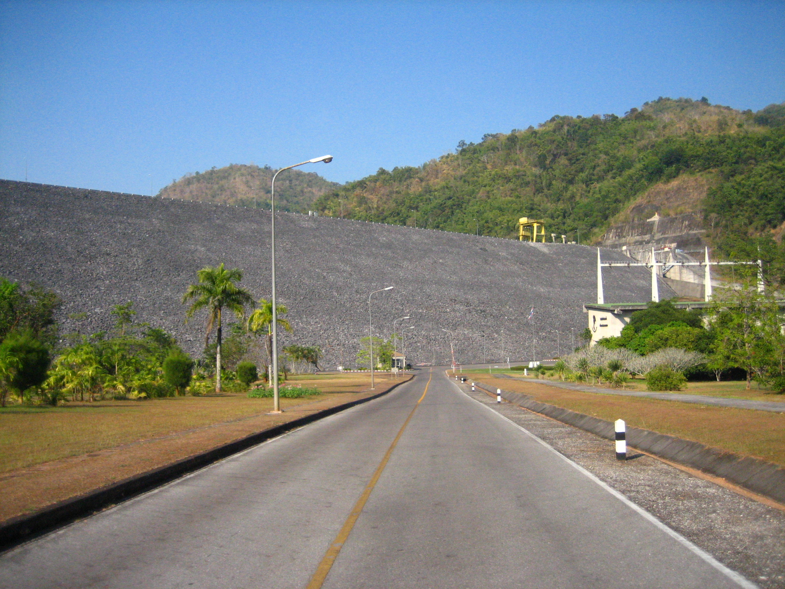
1. Introduction
Nestled amid the emerald hills of western Thailand, เขื่อนวชิราลงกรณ (pronounced Kheun Wachiralongkorn) is more than just a concrete barrier—it’s a gateway to the untouched beauty of the Kanchanaburi highlands. While the dam itself may not boast the towering height of the world’s mega‑dams, its crystal‑clear reservoir, panoramic viewpoints, and proximity to a string of spectacular waterfalls make it a must‑visit stop for any traveler exploring Thailand’s off‑the‑beaten‑path destinations.
Whether you’re a photography enthusiast hunting golden‑hour reflections, an eco‑traveler seeking peaceful river walks, or a family looking for a day‑trip outside Bangkok, the Vajiralongkorn Dam offers a refreshing blend of engineering marvel and natural serenity.
2. About เขื่อนวชิราลงกรณ
A Brief History
Built to harness the power of the Khwae Noi River, the Vajiralongkorn Dam (also known as the Vajiralongkorn Reservoir) was inaugurated in the early 2000s as part of Thailand’s broader hydro‑electric and irrigation strategy. Named after His Majesty King Vajiralongkorn, the dam symbolizes Thailand’s commitment to sustainable water management while supporting local agriculture and electricity generation.
Why It Matters
- Hydro‑Power & Irrigation – The dam supplies clean energy to the surrounding provinces and regulates water flow for rice paddies and farms downstream.
- Ecotourism Hub – Its reservoir creates a calm lake ideal for kayaking, bird‑watching, and sunset picnics, attracting both domestic and international visitors.
- Cultural Significance – The dam’s name honors the Thai monarchy, and nearby villages often host cultural performances that showcase traditional Lanna and Central Thai customs.
For a deeper dive into the dam’s technical specs and history, check the official Wikipedia entry: Vajiralongkorn Dam.
3. How to Get There
From Bangkok
| Mode | Approx. Time | Cost (THB) | Notes |
|---|---|---|---|
| Private Car / Taxi | 3–4 hrs (180 km) | 2,500–3,500 | Take Route 319 toward Kanchanaburi, then follow signs to Thong Pha Phum. The road is well‑paved, with scenic mountain passes. |
| Bus + Minivan | 4–5 hrs | 300–500 | 1️⃣ Bus from Bangkok’s Southern Bus Terminal (Sai Mai) to Kanchanaburi (≈2 hrs). 2️⃣ Transfer to a local minivan at Kanchanaburi Bus Station heading to Thong Pha Phum (≈2 hrs). |
| Train + Taxi | 4–5 hrs total | 250–450 | Take the State Railway of Thailand to Kanchanaburi (train 2‑3 hrs). From the station, hire a taxi or songthaew to the dam. |
From Kanchanaburi City
- Rent a motorbike (≈150 THB/day) and ride the 60 km scenic highway to the dam.
- Local songthaew (shared pick‑up truck) runs daily from Kanchanaburi’s night market to Thong Pha Phum; negotiate a fare of around 200 THB per person.
Parking & Access
A modest parking lot sits at the dam’s main visitor area. Entrance is free, though a small parking fee (≈20 THB) may apply for larger vehicles. The site is wheelchair‑friendly, with paved walkways leading to viewing platforms.
4. Best Time to Visit
| Season | Weather | Why Visit |
|---|---|---|
| Cool Dry (Nov – Feb) | Pleasant 22‑28 °C, low humidity | Clear skies provide the best lake reflections and visibility for distant mountain peaks. |
| Hot Dry (Mar – May) | Warm 30‑35 °C, occasional haze | Ideal for early‑morning kayaking before the heat peaks. |
| Rainy (Jun – Oct) | Frequent showers, lush green foliage | Waterfall flow is at its strongest; the dam’s reservoir swells, creating dramatic misty vistas. |
Tip: The period from late November to early February is the sweet spot for photography, wildlife spotting, and comfortable trekking.
5. What to Expect
Scenic Highlights
- Mirror‑Like Reservoir – The calm water surface acts as a natural mirror, reflecting the surrounding limestone cliffs and forest canopy. Sunrise and sunset shots are especially magical.
- Viewing Platforms – Two main decks overlook the dam’s spillway, offering panoramic views of the Khwae Noi River as it cascades over the concrete gates.
- Picnic Zones – Shaded tables and grills are scattered along the lakeshore, perfect for a family lunch or a romantic al fresco dinner.
Activities
- Kayaking & Paddle‑boarding – Rental kiosks near the main entrance provide kayaks and stand‑up paddle boards (≈150 THB/hour).
- Bird‑watching – The reservoir attracts species such as the Great‑eared Nightjar, White‑winged Duck, and various kingfishers. Bring binoculars!
- Guided Nature Walks – Local guides offer short (1‑hour) treks to nearby forest trails, sharing insights on native flora like Bamboo and Dipterocarp trees.
Atmosphere
Expect a relaxed, low‑key vibe. Unlike the bustling tourist hubs of Erawan National Park or Khao Yai, the Vajiralongkorn Dam area feels like a private retreat. Visitors often linger for hours, soaking in the tranquil sound of water lapping against the dam’s base.
6. Nearby Attractions
The dam’s strategic location makes it an excellent base for exploring a cluster of waterfalls within a 20‑km radius. All distances are measured from the dam’s visitor center.
| Attraction | Distance | Highlights | Link |
|---|---|---|---|
| Nang Kruan Waterfall – Level 3 | 18.0 km | Uppermost tier, steep plunge pool, great for a quick dip. | [Nang Kruan Waterfall Level 3] |
| Nang Kruan Waterfall – Level 2 | 18.1 km | Cascading terraces surrounded by mossy rocks. | [Nang Kruan Waterfall Level 2] |
| Nang Kruan Waterfall – Level 1 | 18.2 km | Gentle cascade, ideal for family picnics. | [Nang Kruan Waterfall Level 1] |
| Unnamed Waterfall (≈18.7 km) | 18.7 km | Hidden gem, reachable via a short forest trail. | — |
| น้ำตกนางครวญ (Nang Kruan Waterfall – Thai name) | 19.1 km | Popular local spot, often featured in Thai travel vlogs. | — |
How to combine: Rent a motorbike and follow Route 319 to the Nang Kruan trailhead. The three waterfall levels are linked by a well‑marked footpath; you can hike all three in a single outing (≈2‑3 hrs). Bring waterproof shoes and a change of clothes if you plan to splash in the pools.
7. Travel Tips
| Tip | Details |
|---|---|
| Dress for the climate | Light, breathable clothing for the hot months; a light jacket for cooler evenings (Nov‑Feb). |
| Footwear | Sturdy walking shoes or hiking sandals; water‑resistant shoes if you’ll explore the waterfalls. |
| Stay hydrated | Carry at least 1.5 L of water per person, especially during the hot season. |
| Cash matters | Small vendors and parking attendants accept only cash (Thai Baht). ATMs are limited near the dam. |
| Respect the environment | Pack out all trash, avoid feeding wildlife, and stay on designated trails. |
| Safety first | The dam’s spillway can create strong currents; never swim near the concrete gates. |
| Connectivity | Mobile signal is moderate; consider downloading offline maps (Google Maps or Maps.me) before you leave. |
| Local etiquette | When visiting nearby villages, dress modestly (shoulders and knees covered) and greet elders with a polite “Sawasdee kha/khrap.” |
| Timing | Arrive early (7‑8 am) to beat the small crowds and capture the sunrise over the reservoir. |
Wrap‑Up
From its tranquil waters to the thundering waterfalls just a short ride away, เขื่อนวชิราลงกรณ offers a rare blend of engineering intrigue and natural wonder. It’s a perfect day‑trip for travelers based in Kanchanaburi, a peaceful stopover for those journeying between Bangkok and the Thai‑Myanmar border, or a quiet base for a weekend of waterfall‑hopping and forest trekking.
Pack your camera, rent a motorbike, and let the Vajiralongkorn Dam reveal a side of Thailand that few guidebooks mention—but every seasoned explorer will cherish.
Happy travels, and may your reflections be as clear as the waters of Vajiralongkorn Dam!