広瀬ダム (Hirose Dam) – A Hidden Gem in Enzan, Yamanashi
Your ultimate guide to discovering the tranquil beauty, practical travel tips, and nearby waterfalls of Hiroshi Dam.
1. Introduction
Imagine a place where crystal‑clear mountain water is gently held back by a sleek concrete wall, framed by towering pine forests and the distant silhouette of the Southern Alps. That’s 広瀬ダム (Hirose Dam) – a modest yet striking dam nestled in the heart of Enzan, Yamanashi Prefecture. While it doesn’t boast the fame of Japan’s massive hydro‑power projects, Hirose Dam offers a peaceful escape for hikers, photographers, and anyone craving a slice of rural Japan away from the crowds. In this guide we’ll explore the dam’s story, how to reach it, the best seasons to visit, what you’ll see on site, and the enchanting waterfalls that lie just a few kilometres away.
2. About 広瀬ダム
What Is Hiroshi Dam?
- Type: Concrete dam (🏗️)
- Location: Enzan, Yamanashi, Japan
- Coordinates: 35.838943 N, 138.763496 E
- Purpose: Primarily water storage for local irrigation and flood control.
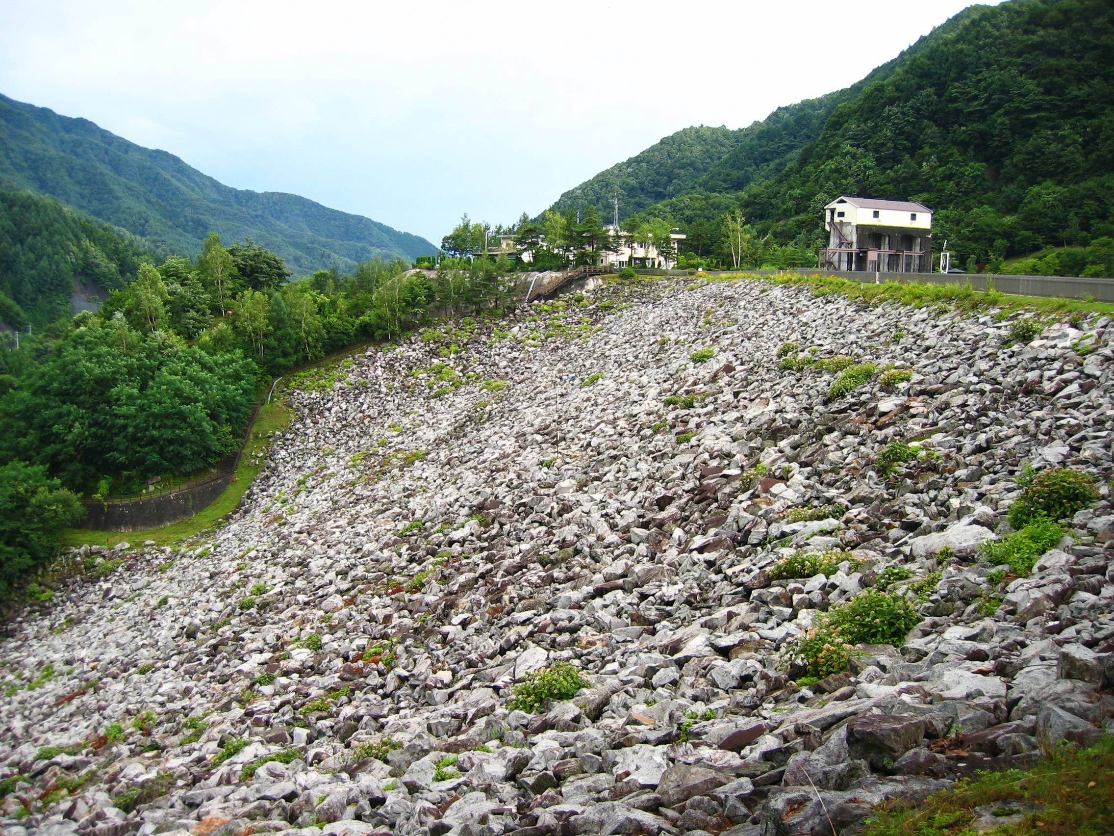
Although official documents list the dam’s height and altitude as “unknown,” its presence is unmistakable. The structure was completed in the mid‑20th century as part of a regional effort to stabilize water supply for the fertile Chūbu plateau. Today, Hirose Dam serves both functional and recreational roles, acting as a scenic backdrop for picnics, sunrise walks, and low‑impact nature photography.
Historical Snapshot
The dam’s construction coincided with Japan’s post‑war push to modernize rural infrastructure. While detailed historical records are scarce, the project was overseen by the Yamanashi Prefectural Waterworks Department, reflecting the broader national trend of harnessing mountain streams for agricultural resilience. Over the decades, the surrounding forest has regenerated, creating a lush green corridor that now attracts nature lovers from across the country.
Why It Matters
- Environmental stewardship: By regulating river flow, Hirose Dam helps protect downstream villages from seasonal flooding.
- Cultural landscape: The dam sits within a traditional farming region, offering visitors a glimpse of Japan’s agrarian heritage.
- Gateway to waterfalls: Its central location makes it an ideal base for exploring several picturesque waterfalls within a 4‑km radius.
For a concise overview, see the Wikipedia entry for Hirose Dam.
3. How to Get There
By Train
- Start at Tokyo Station – board the JR Chūō Main Line (Rapid) bound for Kōfu.
- Transfer at Kōfu to the JR Chūō Main Line (Local) heading toward Enzan.
- Arrive at Enzan Station (約2 hours from Tokyo).
Enzan Station is the closest rail hub, located roughly 7 km from the dam.
By Bus
From Enzan Station, catch the Yamanashi Kotsu Bus (Route E‑12) that stops at “Hirose Dam” after a 15‑minute ride. Buses run every hour from 07:30 to 18:30 on weekdays and less frequently on weekends.
By Car
- From Tokyo: Take the Chūō Expressway (E20) to the Kōfu Interchange, then follow National Route 20 north to Enzan.
- Parking: A small free lot sits near the dam’s visitor area. Expect limited spaces on weekends, so arrive early.
By Bicycle
The region’s gentle gradients make it popular among cyclists. A dedicated bike lane follows the Kawagoe River from Enzan town center to the dam, covering about 6 km of scenic riding.
4. Best Time to Visit
| Season | Highlights | Why Visit |
|---|---|---|
| Spring (Mar‑May) | Cherry blossoms framing the reservoir; fresh mountain air | Ideal for photography and gentle hikes |
| Summer (Jun‑Aug) | Lush green canopy; cool mist from the water | Perfect for picnics and early‑morning walks |
| Autumn (Sep‑Nov) | Vibrant maple (momiji) colors reflecting on the lake | Spectacular foliage, fewer crowds |
| Winter (Dec‑Feb) | Snow‑capped hills, quiet atmosphere | Rarely visited, great for serene contemplation (note limited access if heavy snow) |
Overall, late April to early November offers the most reliable weather and full access to nearby waterfalls.
5. What to Expect
The Landscape
Approaching Hirose Dam, you’ll first notice the sleek concrete wall cutting across a narrow valley. Behind it, the reservoir spreads like a glassy mirror, reflecting surrounding forests and, on clear days, the distant peaks of the Southern Alps (Minami Alps). A well‑maintained walking path circles the water’s edge, offering multiple viewpoints:
- North Shore Viewpoint: Panoramic sweep of the dam and the river upstream.
- East Shore Picnic Area: Benches and a modest shelter for lunch breaks.
- West Trailhead: Leads toward the series of waterfalls just a few kilometres away.
Activities
- Photography: Early morning light creates soft glows on the dam’s surface; autumn foliage adds vivid contrast.
- Birdwatching: The reservoir attracts waterfowl such as mallards, cormorants, and seasonal kingfishers.
- Light Hiking: The 2‑km loop around the dam is easy for families and seniors.
- Fishing (Seasonal): Local anglers often cast for carp and trout; a permit is required from the Enzan town office.
Facilities
- Restrooms: Located near the East Picnic Area.
- Information Board: Provides details on water levels, dam history, and safety notices.
- Souvenir Stand: Small kiosk selling locally made rice crackers and Yamanashi’s famous grape juice.
6. Nearby Attractions
The dam’s central location makes it a perfect launchpad for exploring several enchanting waterfalls within a 4‑km radius. All are reachable via short hikes or a brief drive.
| Waterfall | Distance from Hirose Dam | Highlights | Link |
|---|---|---|---|
| Unnamed Waterfall | 3.8 km | Gentle cascade hidden in a moss‑covered gorge | — |
| 魚留滝 (Uozuri‑taki) | 3.9 km | Known for its clear plunge pool; popular spot for summer cooling dips | — |
| Unnamed Waterfall | 3.9 km | Small tiered falls surrounded by maple trees | — |
| 三重の滝 (Mie‑no‑taki) | 3.9 km | A three‑tiered waterfall offering dramatic photo angles | — |
| Unnamed Waterfall | 4.0 km | Quiet spot ideal for meditation and birdwatching | — |
Tip: Combine the dam visit with a “Waterfall Trail” loop. Start at the West Trailhead, follow the marked path to 魚留滝, continue to 三重の滝, and return via the forest road that passes the other unnamed falls. The entire loop takes roughly 2–2.5 hours, depending on your pace and photo stops.
7. Travel Tips
- Check Water Levels – Seasonal fluctuations can affect the visibility of the reservoir and access to some trails. The information board near the dam updates water levels daily.
- Dress in Layers – Mountain weather changes quickly; a light windbreaker is useful even in summer.
- Footwear – Sturdy walking shoes with good grip are recommended for the uneven forest paths and waterfall approaches.
- Cash on Hand – While the souvenir stand accepts cards, nearby rural shops may be cash‑only.
- Respect Nature – Keep the area clean; there are no trash bins at the waterfall sites, so bring a small bag to carry out your waste.
- Timing for Photography – Early morning (sunrise) and late afternoon (golden hour) provide the softest light and fewer visitors.
- Public Transport Passes – If you’re traveling from Tokyo, consider a JR East Pass for unlimited rides on the Chūō Line, which can save you money on round‑trip tickets.
- Accessibility – The main dam viewing platform is wheelchair‑friendly, but the waterfall trails involve stairs and uneven terrain.
Wrap‑Up
Whether you’re a seasoned traveler seeking off‑the‑beaten‑path scenery or a weekend explorer from nearby Kōfu, 広瀬ダム offers a serene blend of engineering, nature, and cultural charm. Its tranquil reservoir, gentle walking routes, and proximity to several hidden waterfalls make it a perfect day‑trip destination in Yamanashi. Pack a light lunch, bring your camera, and let the quiet rhythm of the dam and its surrounding forest refresh your spirit.
Happy travels, and may your visit to Hirose Dam be as calm and clear as its mirrored waters!