五十里ダム (Igoiri Dam) – A Hidden Gem in Nikko, Tochigi, Japan
Discover the tranquil beauty, local culture, and outdoor adventures that surround one of Tochigi’s lesser‑known dams.
1. Introduction
If you picture Nikko, the first images that come to mind are the ornate Tōshō-gū Shrine, the mist‑capped Kegon Falls, and the vibrant autumn foliage that paints the mountains in fiery reds and golds. Yet, tucked away just a few kilometers from the bustling pilgrimage routes lies a serene water‑filled landscape that many travelers miss: 五十里ダム (Igoiri Dam).
This modest dam may not boast the towering height of Japan’s mega‑dams, but its crystal‑clear reservoir, surrounding forest trails, and proximity to other natural attractions make it a perfect spot for photographers, hikers, and anyone craving a quiet escape from the crowds. In this guide, we’ll dive into the history of 五十里ダム, show you how to reach it, reveal the best seasons to visit, and point you toward nearby waterfalls and dams that can turn a simple day trip into a full‑day adventure in Tochigi.
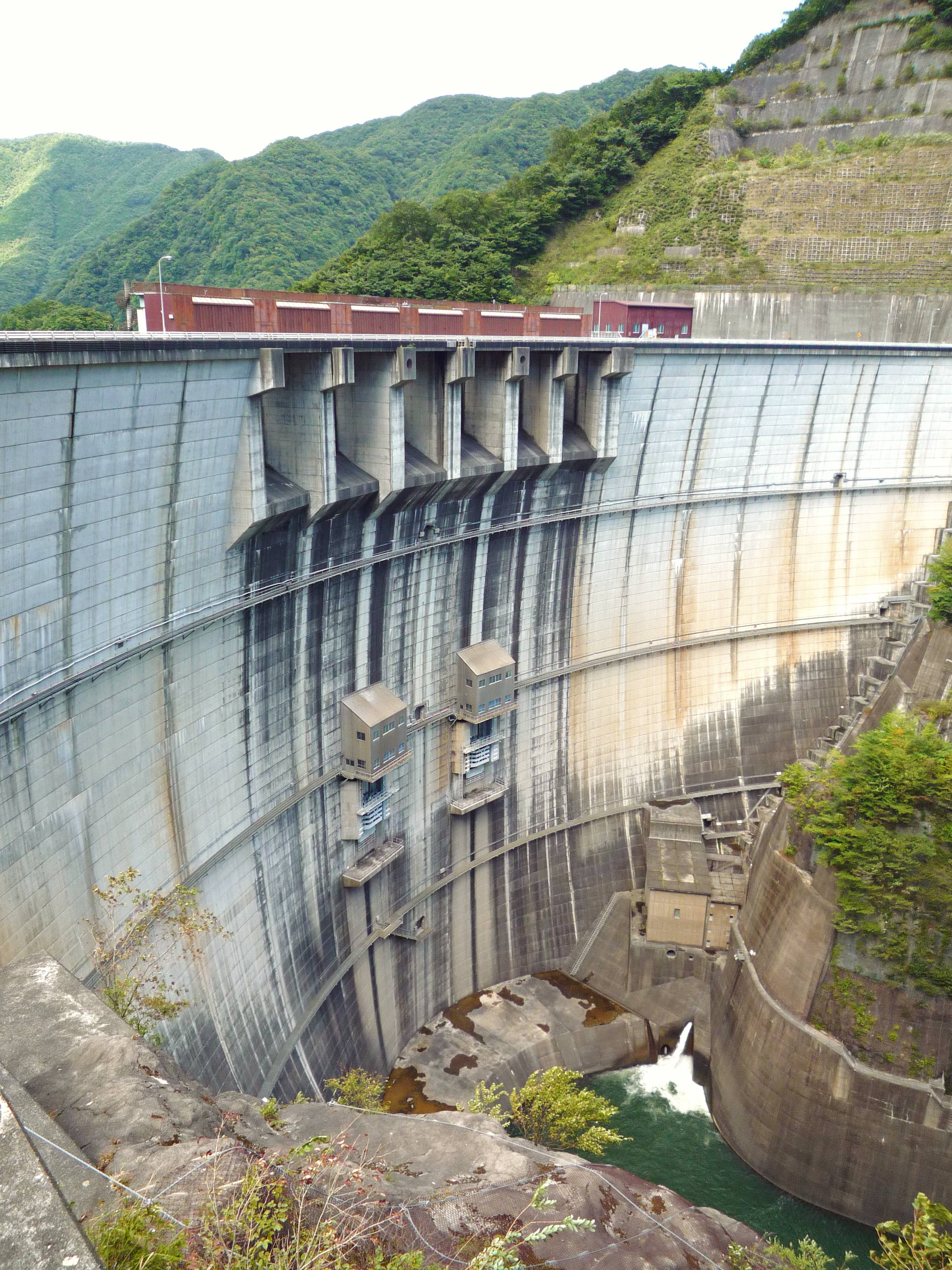
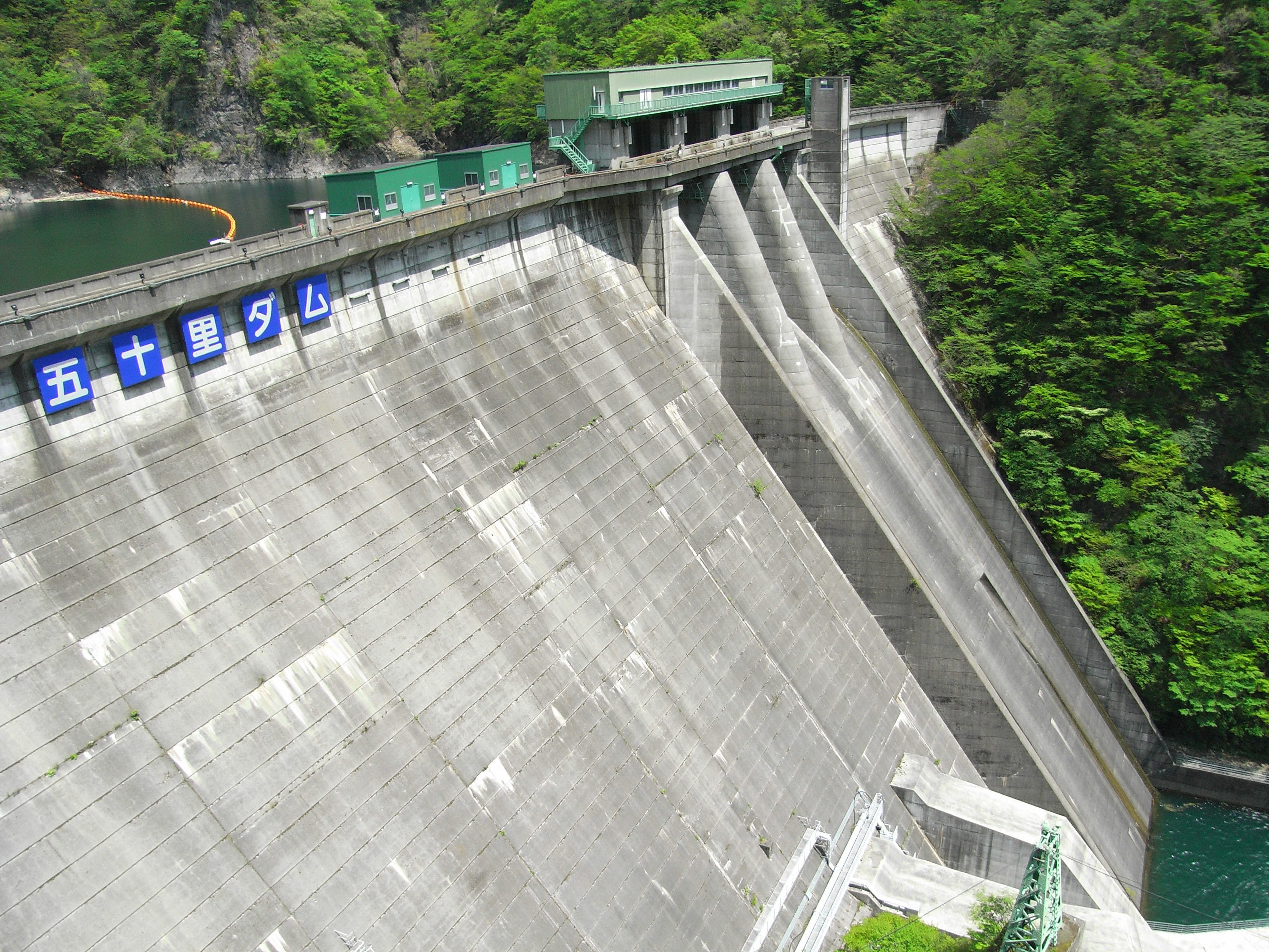
2. About 五十里ダム
- Location: Nikko, Tochigi Prefecture, Japan
- Coordinates: 36.902828 N, 139.705365 E
- Type: Multipurpose dam (primarily for water supply and flood control)
History & Significance
五十里ダム was constructed as part of a regional water‑management project aimed at stabilizing water flow for the surrounding agricultural towns and protecting downstream communities from seasonal flooding. While the exact completion date and structural dimensions are not publicly listed, the dam has become an integral part of the local ecosystem.
The reservoir created by the dam supports a modest fish population, making it a quiet spot for local anglers. More importantly, the dam’s presence has helped preserve the lush forested hills that characterize the Nikko highlands, offering visitors a glimpse of pristine nature that feels worlds away from the tourist‑packed shrine precincts.
Why It Matters to Travelers
- Scenic Views: The dam’s calm waters reflect the surrounding mountains, providing perfect mirror‑like photography opportunities, especially during sunrise and autumn.
- Low Visitor Density: Unlike the crowded spots around Lake Chuzenji, 五十里ダム sees relatively few tourists, giving you space to enjoy the landscape at your own pace.
- Gateway to Outdoor Activities: Trailheads near the dam lead to short hikes that connect to neighboring dams and waterfalls, allowing you to explore a network of water‑centric sites in a single day.
3. How to Get There
From Tokyo
| Transport Mode | Approx. Time | Details |
|---|---|---|
| JR Train + Bus | 2.5 – 3 hrs | Take the JR Tohoku Shinkansen to Utsunomiya (≈1 hr). Transfer to the JR Nikko Line and ride to Nikkō Station (≈1 hr 30 min). From Nikkō Station, catch the Tobu Bus bound for Lake Chuzenji and ask the driver to drop you off at the “五十里ダム” stop (≈30 min). |
| Car (Rental) | 2 – 2.5 hrs | Drive north on the Tōhoku Expressway (E4), exit at Utsunomiya‑IC, then follow National Route 119 toward Nikko. After passing the town center, turn onto Prefectural Road 126; signage for 五十里ダム appears after about 5 km. Parking is available near the dam’s visitor area. |
| Guided Tour | Varies | Several local tour operators in Nikko offer “Off‑the‑Beaten‑Path” day tours that include 五十里ダム, nearby waterfalls, and a tea‑break at a traditional ryokan. Booking in advance guarantees a spot and a driver who knows the best photo‑ops. |
From Nikko City Center
- Bus: The local Nikko Community Bus runs a short loop every hour between the city’s main bus terminal and the dam. The ride is roughly 15 minutes.
- Bicycle: For the adventurous, rent a bike in Nikko and cycle the 7 km scenic route along the river. The road is gently sloping and offers occasional rest stops with panoramic views.
Travel tip: The dam is located at an altitude that can be slightly cooler than Nikko’s town center, especially in early mornings and evenings. Dress in layers and bring a light windbreaker.
4. Best Time to Visit
| Season | Highlights | What to Pack |
|---|---|---|
| Spring (Mar‑May) | Cherry blossoms begin to fringe the reservoir; fresh green foliage adds a soft backdrop. | Light jacket, rain gear (April showers). |
| Summer (Jun‑Aug) | Long daylight hours for extended hikes; the water’s surface glistens under bright sun. | Sun hat, sunscreen, plenty of water. |
| Autumn (Sep‑Nov) | Spectacular koyo (autumn colors) as maples turn crimson and gold—arguably the most photogenic period. | Warm layers, insulated boots for leaf‑covered trails. |
| Winter (Dec‑Feb) | Snow‑capped hills create a serene, almost otherworldly scene; fewer visitors mean true solitude. | Thermal wear, waterproof boots, be prepared for icy paths. |
Peak Recommendation: Late October to early November offers the perfect blend of comfortable temperatures, vivid foliage, and moderate visitor numbers. Arriving early (around sunrise) guarantees the best light for photography and a peaceful atmosphere before the few weekend hikers arrive.
5. What to Expect
The Landscape
Approaching 五十里ダム, you’ll first notice a gentle, wide expanse of water framed by dense evergreen forests. The dam itself is a low‑profile concrete structure that blends into the natural surroundings, allowing the lake to dominate the visual experience.
- Walking Trail: A paved, 1.2 km loop circles the reservoir, equipped with interpretive signs that explain the dam’s function and local flora. Benches spaced every few hundred meters invite you to sit, sip a bottle of water, and soak in the reflections of the mountains.
- Birdwatching: Early mornings attract a variety of waterbirds—kingfishers, herons, and occasional migratory ducks. Bring binoculars for a rewarding wildlife watch.
Activities
| Activity | Details |
|---|---|
| Photography | The calm surface acts like a natural mirror, especially at dawn and dusk. Capture the surrounding peaks, the occasional mist, and the vibrant autumn leaves. |
| Picnicking | Designated picnic spots near the dam’s northern edge provide tables and trash receptacles. Pack a bento and enjoy a lakeside meal. |
| Short Hikes | Branching trails lead to a viewpoint overlooking the neighboring 川治ダム (Kawaji Dam) and 小網ダム (Komō Dam). These are easy walks (30‑45 min) suitable for families. |
| Fishing | Local regulations permit catch‑and‑release fishing for small freshwater species. Check the posted signs for seasonal restrictions. |
Facilities
- Restrooms: Clean public toilets are located near the main parking area.
- Parking: A modest lot (≈50 spaces) is free for day‑use; a small fee applies for overnight stays at nearby campsites.
- Information Center: A small kiosk staffed during peak seasons offers maps, trail guides, and safety tips.
6. Nearby Attractions
While 五十里ダム is a worthy destination on its own, the surrounding area is dotted with additional water‑related sites that can easily fill a day itinerary.
| Attraction | Distance | Type | Quick Note |
|---|---|---|---|
| 川治ダム (Kawaji Dam) | 1.2 km | Dam | A larger concrete dam with a short observation deck. |
| 小網ダム (Komō Dam) | 2.1 km | Dam | Offers a quiet fishing spot and a modest hiking trail. |
| 赤滝 (Aka‑taki Waterfall) | 2.4 km | Waterfall | A 15‑meter cascade hidden in a moss‑covered gorge; best viewed after a short forest walk. |
| Unnamed Waterfall | 3.8 km | Waterfall | A seasonal waterfall that swells during the rainy season; accessible via a gentle trail from the dam’s southern loop. |
Explore More: For detailed directions and trail maps, visit the official Tochigi Prefecture tourism page or check the individual Wikipedia entries (e.g., 川治ダム).
7. Travel Tips
- Check the Weather: The region can experience sudden rain showers, especially in early summer. A portable rain poncho and waterproof shoes will keep you comfortable.
- Arrive Early: Sunrise offers the best lighting for photos and a tranquil atmosphere before the few day‑trippers arrive.
- Respect the Environment: The dam area is a protected water source. Do not litter, and avoid feeding wildlife.
- Cash on Hand: While most larger towns accept credit cards, the small kiosk at the dam and nearby bus stops may only take cash (¥500‑¥1,000 notes).
- Mobile Connectivity: Cellular coverage can be spotty near the reservoir. Download offline maps (Google Maps or MAPS.ME) before you set out.
- Cultural Etiquette: If you decide to stop at a local shrine or small tea house en route, remove your shoes where indicated and speak softly to preserve the peaceful ambiance.
Final Thoughts
五十里ダム may not appear on the typical “must‑see” list for Nikko, but its quiet charm, easy accessibility, and proximity to other natural gems make it a hidden treasure for the discerning traveler. Whether you’re a photographer chasing the perfect reflection, a hiker seeking gentle forest paths, or simply a traveler looking to unwind by a peaceful lake, this modest dam offers a slice of authentic Tochigi that feels both secluded and welcoming.
Pack your camera, lace up your walking shoes, and head north to experience the serene beauty of 五十里ダム—your off‑the‑beaten‑path adventure awaits.
Keywords: 五十里ダム, Igoiri Dam, Nikko dam, Tochigi travel, Japan dam tourism, waterfall near 五十里ダム, how to get to 五十里ダム, best time to visit 五十里ダム, nearby attractions Nikko, Kawaji Dam, Komō Dam, Aka‑taki waterfall.