加治川治水ダム (Kaji River Flood Control Dam) – A Hidden Gem in Niigata, Japan
Discover the serene beauty, engineering marvel, and surrounding nature of 加治川治水ダム, a lesser‑known dam that offers a peaceful retreat for travelers exploring the Niigata prefecture.
1. Introduction
If you’ve already checked off the famous Japanese landmarks—Mount Fuji, Kyoto’s temples, or the bustling streets of Tokyo—consider venturing off the beaten path to Shibata, Niigata. Nestled amid rolling hills and crystal‑clear waterways, 加治川治水ダム (Kaji River Flood Control Dam) stands as a quiet testament to Japan’s dedication to flood management and environmental stewardship.
Beyond its functional role, the dam provides stunning vistas, tranquil walking trails, and easy access to several picturesque waterfalls and neighboring dams. Whether you’re a photography enthusiast, a civil‑engineering fan, or simply a nature lover seeking a calm day trip, 加治川治水ダム is an unexpected highlight of any Niigata itinerary.
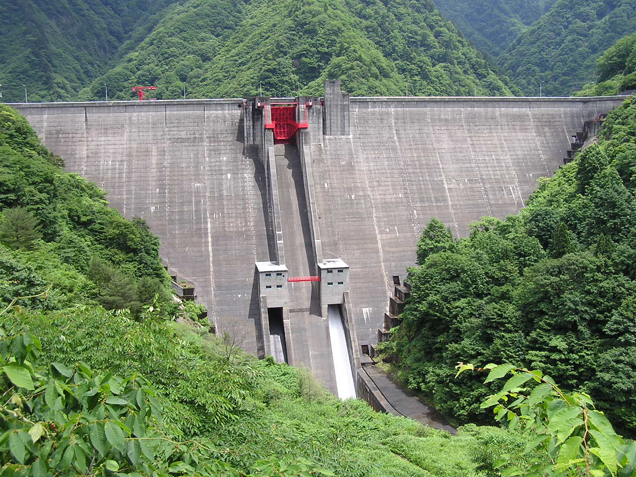
2. About 加治川治水ダム
A Brief Description
- Location: Shibata, Niigata Prefecture, Japan
- Coordinates: 37.814738 N, 139.492129 E
- Type: Flood control dam (治水ダム)
- Primary Purpose: Mitigating flood risk for the Kaji River basin and supporting local water management
While the exact height and altitude of the dam remain unpublished, its presence is integral to the region’s flood‑control network. Built to tame the Kaji River’s seasonal surges, the structure also creates a modest reservoir that reflects the surrounding forested hills, making it a photogenic spot throughout the year.
Historical Context
Construction of 加治川治水ダム aligns with Japan’s post‑war infrastructure boom, a period when the government prioritized robust flood‑control systems to protect agricultural lands and growing urban centers. The dam’s name—治水 (flood control)—highlights its essential role in safeguarding the Shibata area, a region known for its fertile rice paddies and vibrant local communities.
Significance
- Safety: Reduces downstream flood damage during heavy rains and typhoon season.
- Ecology: The reservoir supports local aquatic life and serves as a watering point for wildlife.
- Recreation: Offers a quiet setting for walking, bird‑watching, and photography.
For travelers interested in engineering, the dam’s design showcases Japan’s blend of functionality and respect for natural landscapes—a philosophy that permeates many of the country’s modern infrastructure projects.
3. How to Get There
From Niigata City (the prefectural capital)
| Mode | Approx. Time | Directions |
|---|---|---|
| Train + Bus | 1 h 15 min | Take the JR Shin'etsu Main Line from Niigata Station to Shibata Station (≈30 min). Transfer to a local bus bound for “加治川治水ダム” or “Kaji River Dam” and alight at the nearest stop (≈45 min). |
| Car | 50 min | Drive north on National Route 8 toward Shibata. Follow signs for Kaji River (加治川) and turn onto the local road leading to the dam. Parking is available near the visitor area. |
| Taxi / Ride‑share | 45 min – 1 h | Convenient if traveling with heavy luggage or a group. Request “加治川治水ダムまでお願いします” (please take me to Kaji River Flood Control Dam). |
From Tokyo
- Shinkansen + Train + Bus: Board the Joetsu Shinkansen to Niigata Station (≈2 h 15 min). Then follow the Niigata‑Shibata route described above.
- Domestic Flight: Fly from Haneda or Narita to Niigata Airport (KIJ) (≈1 h 20 min). Rent a car and drive to Shibata (≈40 min).
Practical Tips
- Language: Most station signage is bilingual (Japanese/English). Bus drivers may speak limited English; having the dam’s name written in Japanese helps.
- Timing: Buses run less frequently in the early morning and late evening, so plan to arrive by mid‑day for the most flexible schedule.
4. Best Time to Visit
| Season | Highlights | Why Visit |
|---|---|---|
| Spring (Mar‑May) | Cherry blossoms along the riverbanks, mild temperatures | Ideal for photography; the dam’s reservoir mirrors pink‑white blossoms. |
| Summer (Jun‑Aug) | Lush green foliage, cool breezes from the water | Perfect for a refreshing walk; occasional fireworks in nearby Shibata festivals. |
| Autumn (Sep‑Nov) | Vibrant red‑orange maple leaves (momiji) framing the dam | The most photogenic period; the water reflects the fiery canopy. |
| Winter (Dec‑Feb) | Snow‑capped hills, quiet atmosphere | A serene, almost mystical landscape; fewer crowds. |
Peak Visitor Period: Late April (cherry blossom) and mid‑October (autumn colors). If you prefer solitude, aim for early December or late January when the region is quiet but still accessible.
5. What to Expect
Scenic Walks & Photo Ops
A modest, well‑maintained trail circles the reservoir, offering several lookout points:
- East Viewpoint: Overlooks the dam’s spillway with the Kaji River winding downstream.
- North Picnic Spot: Flat grass area with benches—great for a quick lunch or tea.
- West Trail: Slightly rugged, leading to a small wooden bridge that frames the water against distant hills.
The area is largely undeveloped, meaning you’ll encounter minimal crowds and plenty of space to set up a tripod for sunrise or sunset shots.
Wildlife & Birdwatching
Early mornings bring a chorus of birds—kingfishers, Japanese bush warblers, and occasional waterfowl. Keep an eye out for dragonflies skimming the surface of the reservoir.
Facilities
- Parking: Free lot near the visitor center (capacity ~30 cars).
- Restrooms: Clean, gender‑separated facilities at the main entrance.
- Information Board: Provides details on dam operation, safety guidelines, and a map of nearby attractions.
Safety
The dam is an active flood‑control structure, so certain areas (e.g., the spillway) are fenced off. Follow posted signs and stay on designated paths.
6. Nearby Attractions
A short drive or bus ride expands your itinerary with additional natural and engineering sights. All distances are measured from 加治川治水ダム.
| Attraction | Type | Distance | Why Visit | Link |
|---|---|---|---|---|
| 飯豊川第1ダム | Dam | 2.2 km | Another impressive flood‑control dam with a larger reservoir—great for comparative photography. | 飯豊川第1ダム |
| Nana Falls | Waterfall | 5.3 km | A cascading waterfall surrounded by mossy rocks—ideal for a short hike and a misty photo backdrop. | (link placeholder) |
| (weir) | Weir | 6.7 km | A small weir offering a quiet spot for fishing and local flora observation. | (link placeholder) |
| 内の倉ダム | Dam | 7.1 km | Lesser‑known dam with a tranquil lake perfect for paddle‑boarding in summer. | (link placeholder) |
| Imose Falls | Waterfall | 10.5 km | One of Niigata’s most scenic waterfalls, especially striking after autumn rains. | (link placeholder) |
Suggested Day Trip: Start at 加治川治水ダム in the morning, head to Nana Falls for a midday hike, and finish with a sunset view at Imose Falls. Pack a bento box and enjoy a picnic near the weir for a truly local experience.
7. Travel Tips
- Dress in Layers: Niigata’s weather can shift quickly, especially near water. A light rain jacket is advisable year‑round.
- Bring Cash: Small vending machines and local eateries may not accept credit cards.
- Footwear: Sturdy walking shoes or light hiking boots are best for the uneven trail sections.
- Timing for Photos: Early morning (sunrise) and late afternoon (golden hour) give the dam’s surface a magical glow.
- Respect the Environment: Stay on marked paths, avoid littering, and follow any signage regarding wildlife protection.
- Check Dam Operations: Occasionally, water levels are lowered for maintenance. Verify the status on the Niigata prefectural website or at the visitor center before you go.
- Local Cuisine: Near Shibata Station, try the regional specialty “Koshihikari” rice dishes or fresh Niigata sashimi—the area is famed for its high‑quality seafood.
Final Thoughts
加治川治水ダム may not appear on the typical Japan travel checklist, but its blend of functional engineering, natural beauty, and proximity to other hidden gems makes it a rewarding stop for any traveler seeking authentic Niigata experiences. Whether you’re chasing the perfect autumn leaf photograph, exploring Japan’s flood‑control heritage, or simply looking for a peaceful place to unwind, the Kaji River Flood Control Dam welcomes you with open arms—and a calm, reflective surface that mirrors the heart of the region itself.
Pack your camera, lace up your shoes, and let 加治川治水ダム become a memorable chapter in your Japanese adventure.
