石羽根ダム (Ishibane Dam) – A Hidden Gem in Kitakami, Iwate
Discover the quiet charm of Ishibane Dam, a modest yet picturesque waterworks that offers a perfect slice of rural Japan for travelers seeking off‑the‑beaten‑path scenery.
Introduction
If you’ve already trekked through the bustling streets of Tokyo or the historic temples of Kyoto, it’s time to turn your compass toward the tranquil north‑east of Honshu. Nestled in the verdant hills of Kitakami, Iwate Prefecture, 石羽根ダム (Ishibane Dam) may not appear on the typical “must‑see” list, but its gentle waters, surrounding forest trails, and panoramic mountain backdrop make it a rewarding stop for nature lovers, photography enthusiasts, and anyone craving a peaceful escape.
In this travel guide we’ll walk you through everything you need to know: the dam’s background, how to reach it, the best seasons to visit, what you’ll experience on site, nearby attractions, and practical tips to make your trip smooth and enjoyable.
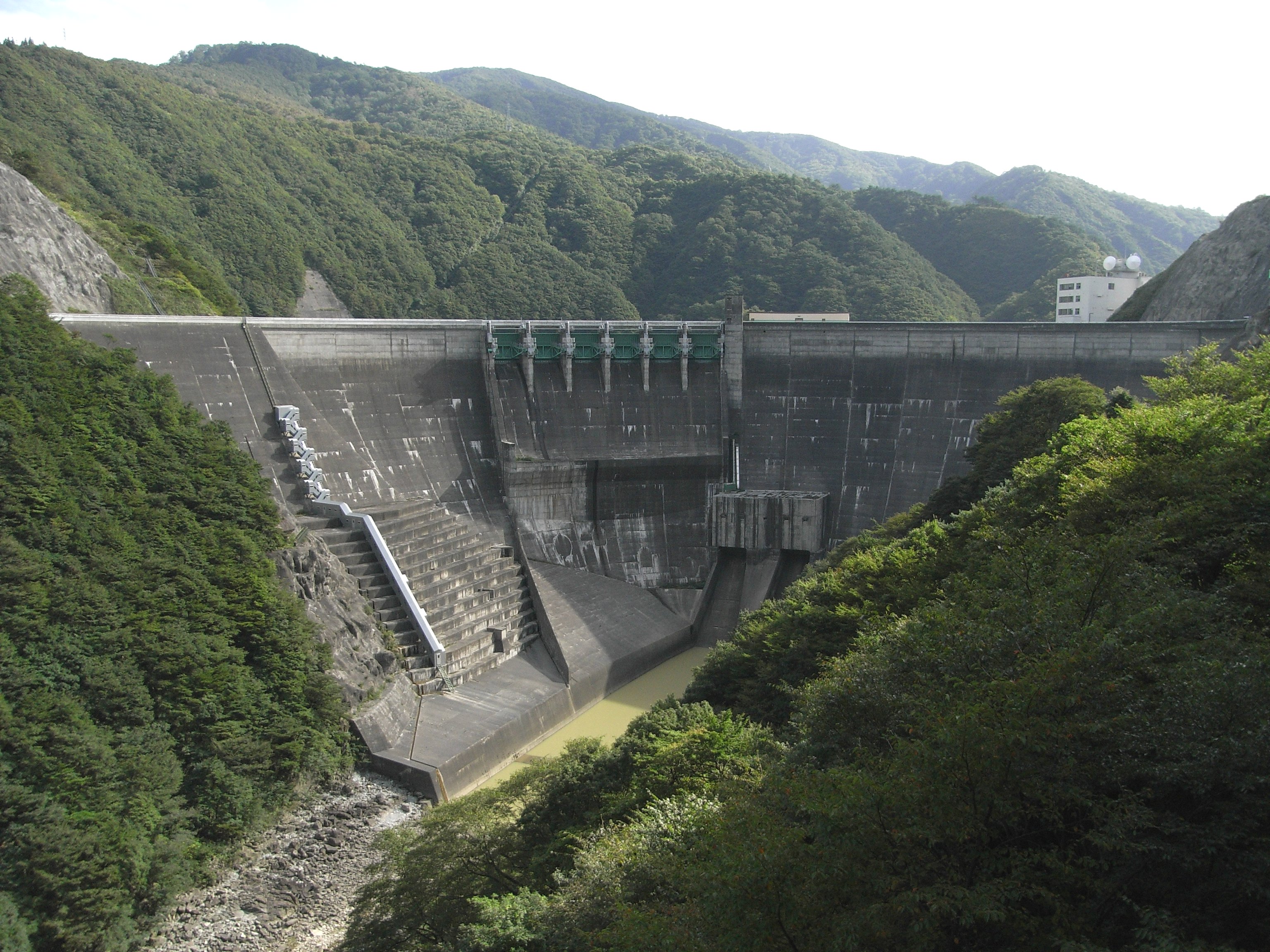
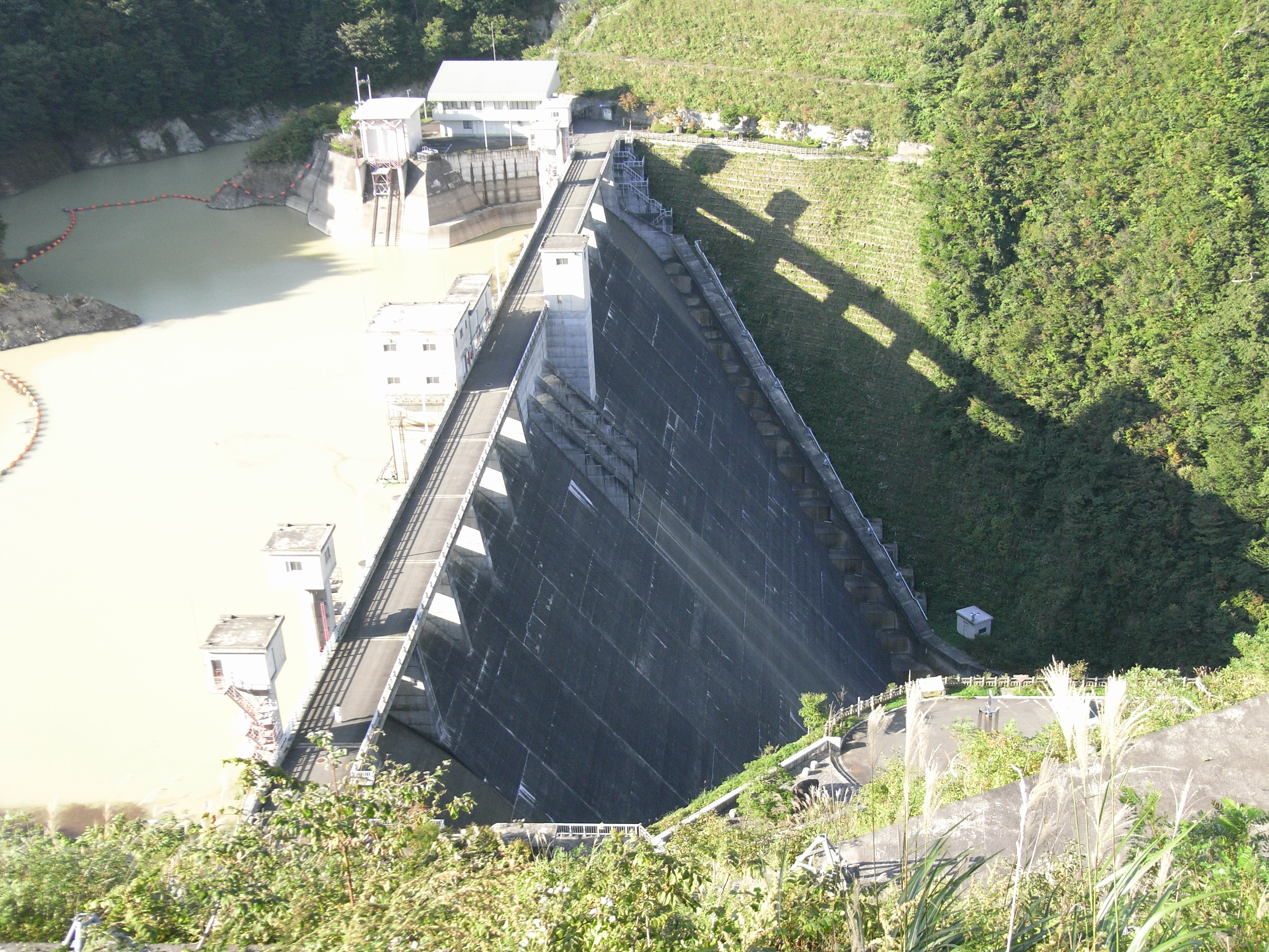
About 石羽根ダム
- Location: Kitakami, Iwate, Japan
- Coordinates: 39.304870 N, 140.953892 E
- Height: 20.5 m
- Type: Small concrete dam (🏗️)
Ishibane Dam is a modest‑sized water‑control structure that serves the local community for flood mitigation and water supply. While it doesn’t boast the massive scale of Japan’s famous hydro‑power dams, its 20.5‑meter height blends seamlessly into the surrounding landscape, creating a calm reservoir that mirrors the changing seasons.
The dam’s name, 石羽根 (Ishibane), translates roughly to “stone feather,” a poetic nod to the delicate way the water seems to glide over the stonework. Although detailed historical records are limited, the dam’s construction reflects Japan’s post‑war emphasis on rural infrastructure development, ensuring reliable water resources for agriculture and small towns in Iwate.
For a quick reference, you can explore the Wikipedia entry here: Ishibane Dam.
How to Get There
By Train & Bus
- Start at Kitakami Station (JR East – Tōhoku Main Line).
- From the station, board a local bus heading toward the Ishibane area. The route is serviced a few times a day; check the latest timetable at the Kitakami Bus Center.
- Get off at the Ishibane Stop (約5 km from the station). From there, it’s a short 15‑minute walk or a quick taxi ride to the dam’s parking lot.
By Car
- From Kitakami City Center: Take Route 4 (National Highway 4) north toward the rural outskirts. After about 12 km, turn left onto Prefectural Road 71 (石羽根道路). Follow the signs for “石羽根ダム” – the road leads directly to a small, free parking area near the visitor viewpoint.
- From Morioka (the prefectural capital): Drive south on the Tōhoku Expressway (E4), exit at Kitakami‑IC, then follow the same local directions. The total drive is roughly 45 minutes (≈70 km).
By Bicycle
Iwate’s countryside is bike‑friendly, and the route from Kitakami Station to the dam is a popular leisurely ride for locals. Expect gentle hills and scenic rice paddies; bring a lock and a water bottle.
Pro tip: Download an offline map (e.g., MAPS.ME) with the coordinates 39.304870, 140.953892 to avoid getting lost in low‑cell‑signal areas.
Best Time to Visit
| Season | Highlights | Why Visit |
|---|---|---|
| Spring (Mar‑May) | Cherry blossoms framing the dam, fresh green shoots | Ideal for photography and gentle weather |
| Summer (Jun‑Aug) | Lush foliage, occasional fireflies at dusk | Perfect for picnics and cool river breezes |
| Autumn (Sep‑Nov) | Vibrant maple and ginkgo leaves turning crimson and gold | Spectacular foliage reflections on the water |
| Winter (Dec‑Feb) | Snow‑capped hills, tranquil icy surface | Quiet, meditative atmosphere; great for winter hikers |
Because Ishibane Dam is relatively low‑key, it never feels overcrowded. However, the autumn foliage period (late October to early November) draws the most visitors, so arriving early in the day will secure the best viewpoints and parking spots.
What to Expect
Scenic Views
From the main observation deck, you’ll see the dam’s concrete wall juxtaposed against a backdrop of rolling hills. The reservoir’s surface often mirrors the sky, creating a painterly effect that changes with the weather. In spring, cherry trees line the banks; in autumn, the water reflects a kaleidoscope of reds and yellows.
Walking Trails
A short, well‑maintained trail circles the reservoir (≈1.2 km). The path is mostly flat, making it accessible for families and casual walkers. Look out for informational plaques that explain the dam’s purpose and local ecology.
Wildlife
The surrounding forest is home to Japanese bush warblers, kingfishers, and occasional deer. Early morning or late afternoon is the best time for birdwatching. Bring a pair of binoculars if you’re keen on spotting the elusive Japanese pygmy woodpecker.
Picnic Spots
Designated benches and a modest picnic area sit near the water’s edge. Pack a bento or pick up local rice crackers from a nearby convenience store in Kitakami. Remember to carry out all trash—there are no waste bins on site.
Photography
Golden hour (just after sunrise or before sunset) offers the most dramatic lighting. The dam’s simple geometry makes for striking minimalist compositions, while the surrounding nature provides vibrant color palettes.
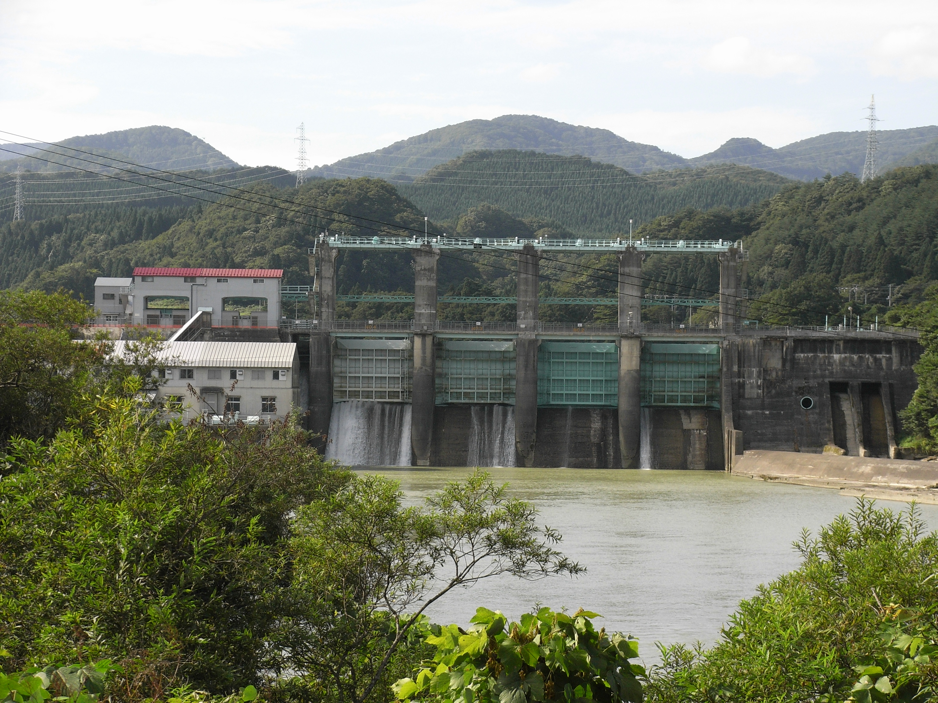
Nearby Attractions
While Ishibane Dam can easily fill a half‑day itinerary, the surrounding region offers several additional sights worth exploring. All are within a 10‑km radius, making them perfect for a relaxed day trip.
| Attraction | Type | Distance from Ishibane Dam | Quick Info |
|---|---|---|---|
| Unnamed Weir | Weir | 2.3 km | A small river weir surrounded by bamboo groves—great for a quiet stroll. |
| Unnamed Weir | Weir | 4.1 km | Offers a charming wooden footbridge and seasonal wildflower displays. |
| 湯田ダム (Yuda Dam) | Dam | 6.0 km | Larger reservoir with a lakeside park, fishing spots, and a small café. |
| Unnamed Weir | Weir | 7.0 km | Known for its clear water and a short trail leading to a hidden waterfall. |
| 入畑ダム (Irihata Dam) | Dam | 7.2 km | Features a modest hiking loop with panoramic views of the Kitakami valley. |
Tip: Use a local map or a GPS app to locate these spots; many are signposted in Japanese, but the distances are short enough to navigate by car or bicycle.
Travel Tips
- Check Seasonal Access – Heavy snowfall in winter can temporarily close some rural roads. Verify road conditions with the Kitakami City office or the Iwate Prefecture travel website before heading out.
- Parking – The dam’s parking lot is free but limited to about 30 spaces. Arriving before 9 am on weekends ensures a spot.
- Facilities – There are no restrooms or vending machines on site. Use the facilities at Kitakami Station or nearby convenience stores before you go.
- Safety – The reservoir’s edge can be slippery, especially after rain. Stay on marked paths and keep children supervised.
- Respect Local Culture – The area around Ishibane Dam is primarily agricultural. Avoid trampling crops and be mindful of local residents.
- Connectivity – Cellular service can be spotty. Download offline maps and any necessary language translation apps in advance.
- Photography Gear – A lightweight tripod and a polarizing filter can help capture the water’s reflections without glare.
- Food – Pack a lunch or snacks. While there are no eateries at the dam, Kitakami’s downtown offers fresh seafood, especially “masago” (capelin roe) and “wanko” (small bowls of rice) dishes.
Wrap‑Up
Stone‑feathered serenity, seasonal color changes, and a gentle river ambience—石羽根ダム (Ishibane Dam) embodies the understated beauty of rural Iwate. Whether you’re a solo traveler chasing quiet moments, a family looking for a safe outdoor spot, or a photographer hunting for reflective water scenes, this hidden dam delivers an authentic slice of Japan far from the crowds.
Plan your journey, respect the environment, and let the calm waters of Ishibane Dam refresh your wanderlust. Safe travels!